Email : udupiagraharam@gmail.com
Phone : +91 9846 290052, +91 4936 296011
Phone : +91 9846 290052
Distance : 40.2 Km
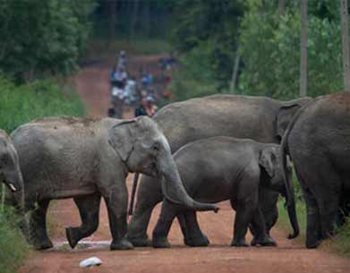
Spread over a vast area, Muthanga is a part of the Nilgiri Biosphere region. Located 18 kms east of Sulthan Bathery, it is a rain foprest reserve connected to two major sanctuaries - Bandipur National Pak and Mudumalai Sanctuary in Tamilnadu.

Distance : 24 Km
At 2100 meters, the spectacular Chembra peak located towards the southern part of wayanad is the tallest summit in the region. Climbing this peak is a challenging mountaineering endeavour and would take a full day.
Distance : 30.5 Km
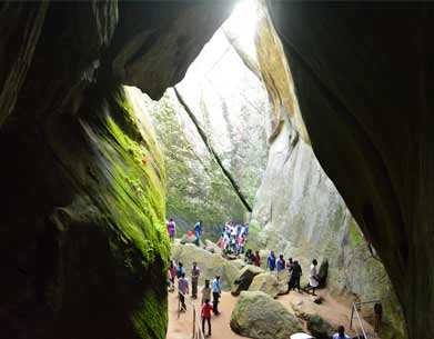
An interesting trek up the Ambukuthy hill near Ambalavayal town takes you to the fascinating neolithic cave site of Edakkal. Etchings found on the walls of this caves have drawn the serious attention of archaeologists and historians worldwide.
Distance : 24.7 Km
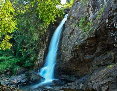
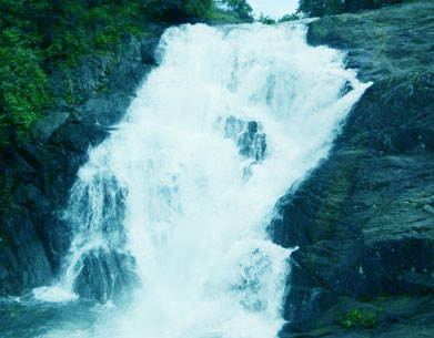
Locally known as Soochipara, this is a very porular leisure destination. While younger visitors love to romp in the pool formed at the foot of the fall, the more restrained can have equally good fun just taking in the scenery.

Distance : 37.1 Km
The Kuruva Island with the 950 acres of evergreen forests lies on one of the tributaries of the River Kabani This calm and peaceful Island is home to a variety of birds, butterflies and orchids.

Distance : 9 Km
Set in a beautiful valley and surrounded by evergreen forests and wooded hills, Pookote is one of Wayanad's top visitor draws. This natural lake near Lakkidi is just a short distance off the NH 766
Distance : 20.5 Km
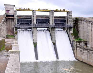
The large Irrigation baased dam site is set amidst picturesque surroundings. It is another fine venue for picnics.

Distance : 14.5 Km
A 10.5 acre lake with a charming grove surrounding it,Recreational park with facilities for boating fecilities are available right now.Karald is now being developed as a centre of base camp for Adventure activities like Zip-Line,angling, Archery, Panit Ball, Tented accomodation and Water Zorbing.
Distance : 50.8 Km
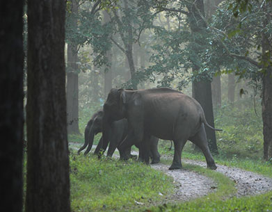
Situated along northern ridge of Wayanad(bordering coorg district of Karnataka) Tholpetty is much similar to Muthanga in terms of flora and fauna. The best season to visit both sanctuaries is between Nov and May.
Distance : 19 Km
Considered to be largest earth dam in India, the Banasura Project precincts are an ideal starting point for treks to the Banasura peak. A quaint feature is a series of island that were formed when the reservoir submerged the surrounding areas.

Distance : 19.5 Km
Wayanad Ghat pass also known as Thamarassery Churam is along the National Highway NH766 connecting Kozhikode with Wayanad. Wayanad Ghat road is the most beautiful in South India stretching 14 Kms and having 9 hairpin bends with each turn taking one to a higher altitude
Distance : 20 Km
Relatively smaller than sentinel rock, and rather less frequented, Kanthanpara and it's surroundings are nonethless very pleasant. An easy hike away from the main road, it's perfect for picnics.
Copyright © All Rights Reserved Udupi Agraharam. Powered by TelNet Info Solutions.


